
I always passed this hill, saw the saffron flag flutter on the peak and then wondered what it was called. A few months later I found out what it was called, another few months later I saw bus route number 250 and I resolved to get there. I was to look at it wistfully for another 6 years, without acting upon my resolution. So when a plan was hatched last week, I decided to finally hike up to the peak of Gilbert Hill. If you wish to hike all the way up, never ask the locals for Gilbert Hill. The entire neighbourhood around this column of basalt derives its name from it. Unsurprisingly so, consider this – this volcanic formation has been around for sixty-five million years.

A book written by Kalpish Ratna (Once upon a Hill, 2008, Harper Collins) throws light on how the hill got its name. The Basalt rock of the hill is a specimen of an intrusive volcanic rock formation known as laccolith, and is named after Grove Karl Gilbert, the geologist who came up with the term laccolith. Many news reports say it was named after an officer named Gilbert, perhaps a divisional officer of the Undheree Taluka. But today, if you were to ask how to get to Gilbert Hill, they will ask you where in Gilbert Hill. If the peak is your objective then the Gaodevi Mandir is what you should ask for. We walk past one of the few single screen cinemas of the suburbs – Navrang(that now plays Bhojpuri movies) and turn towards Bhavan’s college and then turn left in that lane that says Shri Gaodevi Durgamata Mandir Marg.
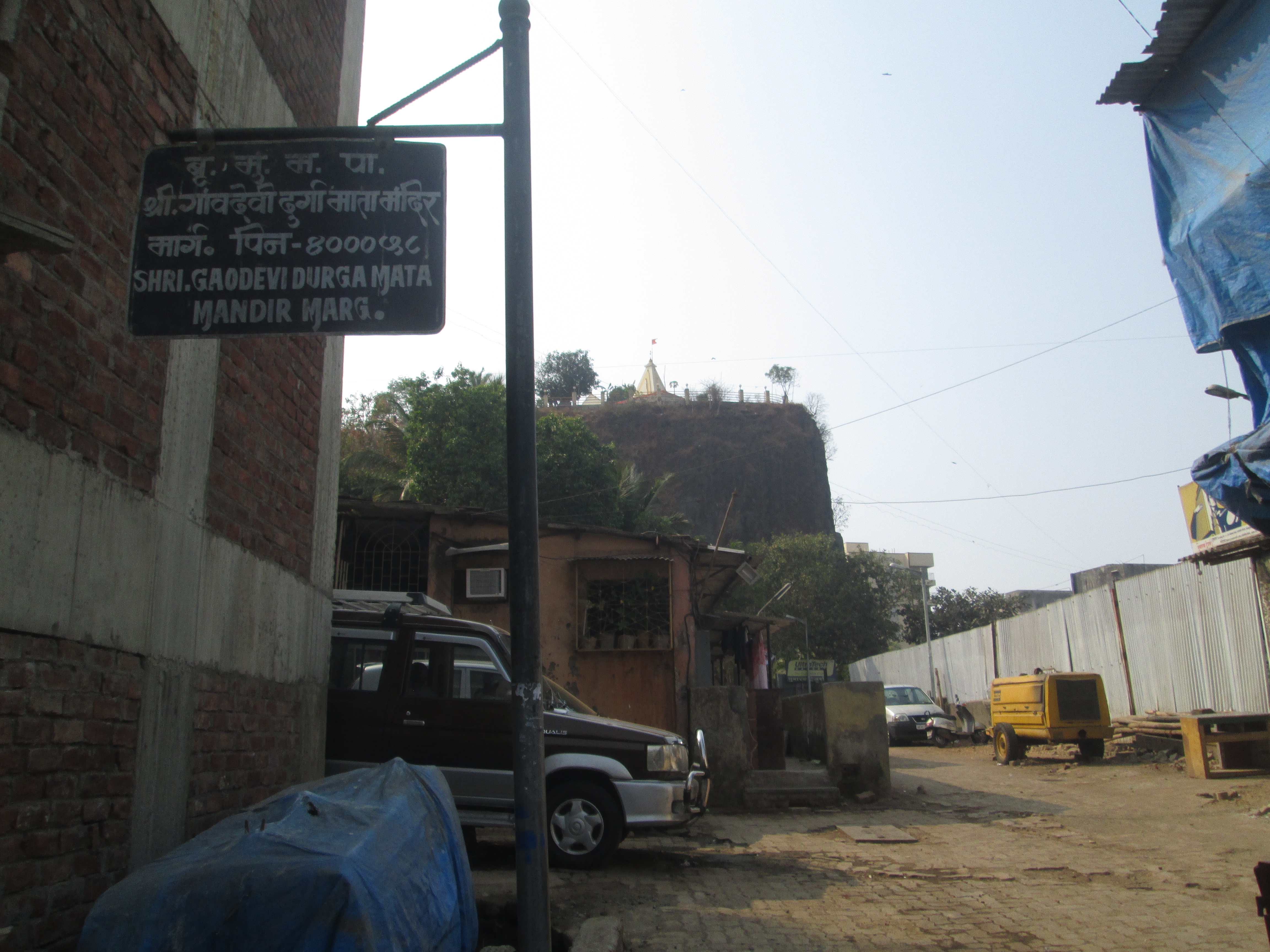
I confirm our route. A rickshaw driver with paan stained teeth tells us to climb straight up the incline and walk until we reach a green shouchalaya (public toilet) and then take a right there. There are steps to go to the top, he adds. We start trudging up the hill, the incline getting steeper at places. On either side are muslim households but the area is known as Ajmera Chawl. This group of houses have been around since a long time and this is a well known muslim ghetto. We ask a few local boys about the mandir and they enthusiastically point us in the right direction. It’s a good walk through the narrow lane and soon we reach the toilet, turn right and that’s when we catch the first glimpse of it.

A tall block of rock, standing stark in midst of two SRA buildings. White walls of the temple at the peak are visible. Signs of quarrying are evident as we cross a small gate. A series of steps built for ease of climbing exist but are in repair. We ascend them slowly, taking in the view. To our right and back, lie the shanties of Ajmera Chawl and to the east stretches a maze of buildings.

A red silk cotton tree is in bloom and its red flowers stand out on the bare, leafless branches. We move up the final stretch and remove our shoes and slowly move around the temple. A nice walkway around makes it easier. The north, south and east are quite similar in appearance.

Concrete jungle interspersed with modern day infrastructure. T2 is visible and so is the new ATC, domestic terminal and it seems on a clear day, you can see the Bandra Worli sea link too. To the far east lies Aarey colony, and further north is the Sanjay Gandhi National Park.

But what holds my attention is the western view. It is a smoggy day, so at first the buildings to the far west seem to stand against a white background, but on squinting I can see the waters of the Arabian shimmering in the afternoon sun. Further out, we can see the palms of Madh and the residential towers, a couple of boats can be seen too.

Turning around, we stand to look at the temple. On the peak lies the Gaodevi Durgamata Mandir, which literally translates to Village Deity – Mother of the Hill temple, it stands tall on the peak at 200 feet above sea level. Opposite to it is also a Hanuman temple. They both are nearly 500 years old, the Pujari tells me. Every year on Hanuman Jayanti, a Palkhi (palanquin) procession is taken out that sort of goes circumambulating the hill. The mandir trust seems to be the one that has been caring for the hill and has been fighting off encroachment but is also responsible for the wear and tear of the rock.

Earlier, there existed a plateau around this column. A full fledged hill. But in the 1930s, a contract was awarded to a builder to quarry the hill for developing the land around. The stone was crushed and was used to make roads. Undheree as it was earlier known was slowly transforming and in a way still is. The hill is made of many columns which sometimes fall off and could cause damage to life and property. The last such incident happened in July 2005 but no one was hurt.
Gilbert Hill has potential to be developed into a sustainable tourist attraction. It has immense geological and historical value. The closest specimen of such a rock is the Devil’s Tower in Wyoming, nearly four times tall as compared to Gilbert Hill. Gilbert is even more prodigious because it has withstood the pressures of urbanisation which its American cousin didn’t have to. In 1952, Gilbert Hill was declared a national park but not treated like one. It is high time, that the Grade 2 heritage structure allotted to it is taken seriously and concentrated conservation efforts are employed to preserve this unique heritage of our city.

Prohibition of further development, shifting of the population of Ajmera Chawl to an alternate locality under a rehabilitation and upliftment scheme which will ensure they have better housing, access to toilets and sanitation. Setting up guided tours of the structure by training local boys and girls could also help inculcate a sense of pride and help in conservation and tourism efforts. Efforts for its conservation are visible on social media which highlight the plight of the hill but until the government intervenes, things look bleak for Gilbert Hill.
To get down, I am told to take the road opposite to where I came from. It passes through a small group of houses and I find myself on a familiar street. This is the stretch of road that connects to SV Road, and runs uphill from the opposite side of Nadco Shopping Centre, Andheri west. Sagar city is a prominent landmark. We reach SV road within no time and head to Merwan’s to stuff ourselves with their amazing rolls. This route is shorter, nearer to the station and one can reach the steps within 15 minutes from the station as opposed to the Navrang-Ajmera route.
Planning your visit:
Getting there: From Andheri West SV road, take the road opposite to Nadco Shopping Centre, after ascending it, you will encounter a small settlement, turn right there and you will be at the steps of Gilbert Hill.
Time to visit: Mornings or evenings are the best. The temple itself remains shut from 12 – 4 pm but the surrounding area is open to visitors.
Dress conservatively, carry a cap and a pair of binoculars if you’d like to spot most landmarks of the city.
An interesting documentary made by a student sums up most issues faced by Gilbert Hill.

Thanks for sharing. Amazing how it has stood the test of time and the invasions of the urban concrete jungle.
I have been hearing so much about it, and hope i see it before its too late 😦 its so sad to see the condition and the indifference to such a beautiful and interesting structure, which, anywhere in the else would have been cared for and promoted as a tourist attraction! which just reinforces the thought that we dont really know or care about our heritage. we first need to get people to be proud of all that we have.. an uphill task indeed!
OMG! ive always wondered abt it too!! Thanks for finally solving the mystery! 🙂
I can now die in peace! 🙂
Rithika, the invasion of man is more disastrous than forces of nature! Anuradha, I think the government along with the local residents can really overhaul this place, but then again the will to do so is missing on either sides. Lucille, you are welcome! Now do visit it 🙂
Recently I visited Gilbert Hill. This was my third visit.
Such a riveting narration of the visit as well as history of the place! I visited Gilbert hill a couple of years back and after going through your pictures, I am sad to say that the situation hasn’t improved much, if at all.
The approach road through the chawl is still narrow and the exit towards SV road is flanked by a pile of garbage. Quite inconceivable how the heritage structure has been continuously neglected for decades altogether.